Home Français
June 28 to July 1st July 2 - 4 July 5 - 7 July 8 - 10 July 11 - 14 July 15 - 23
July 5 to 7, 2007
Choosing the photos for today was very hard, so many good ones.
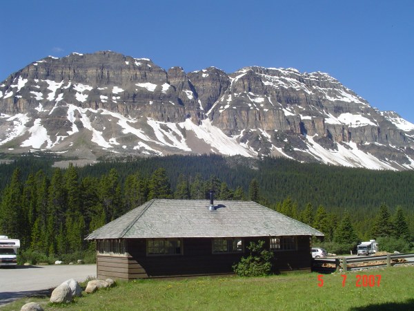
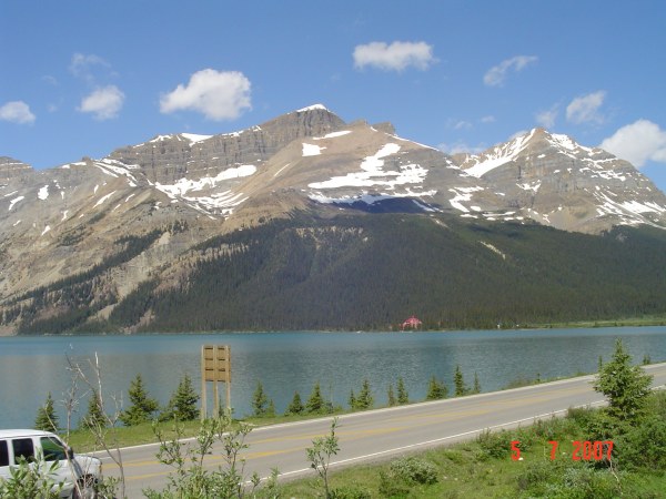
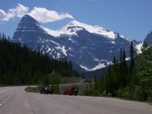
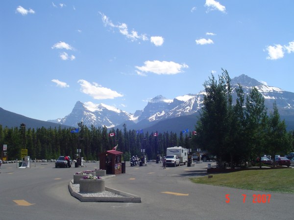
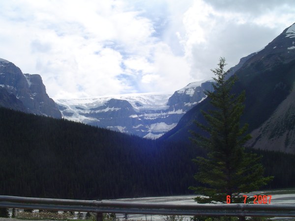
OK! Here is one of the mountains. We can see from our campground.
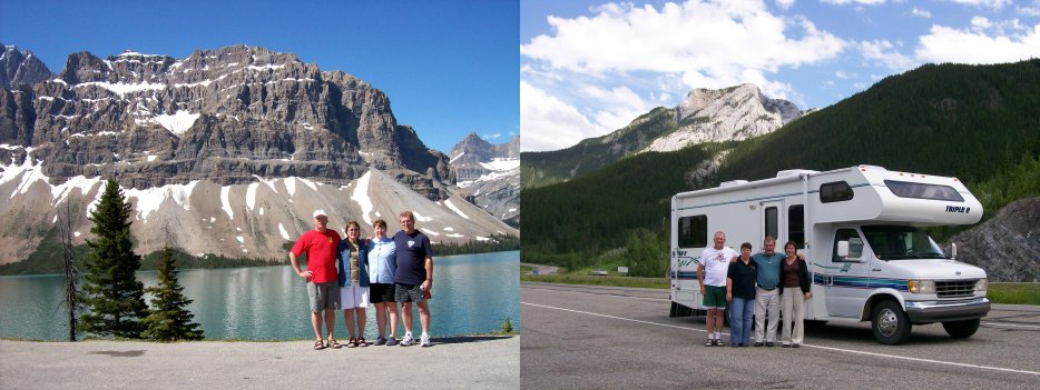
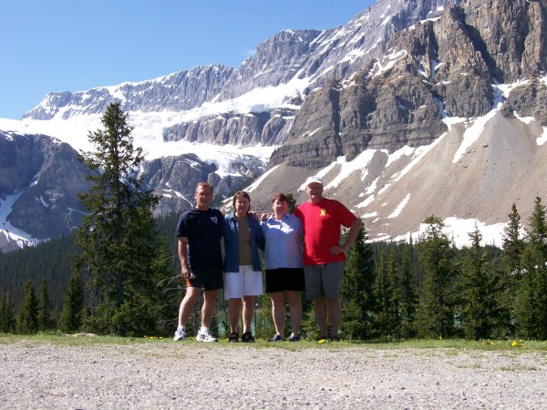
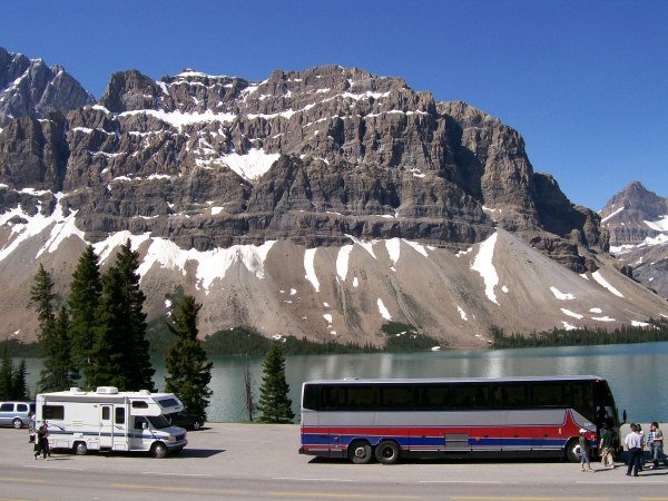
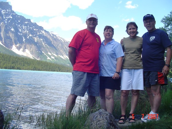
The four of us at Bow Lake with the Crowfoot lake and glacier.
Beautiful lake.
The house you see in the distance is actually a lodge, the Num-Ti'Jah Lodge. It is 4 stories high.
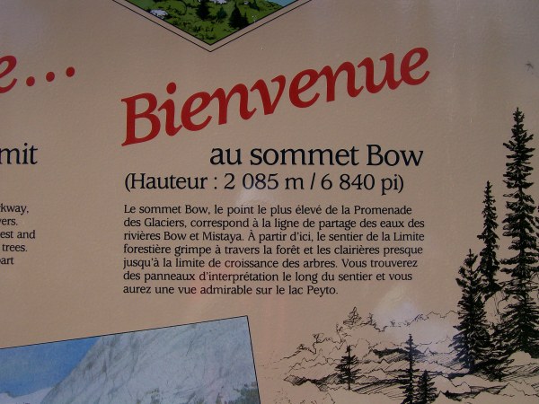
Sorry, but I did not take the English version of the information. Just to tell you that we are very high, at 2,085 m. This is the highest point on the parkway.
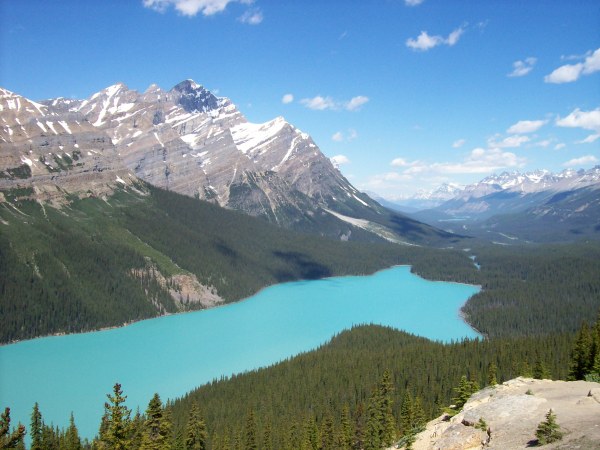
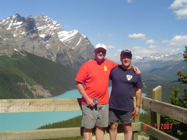
Peyto Lake, named after the explorer Mr. Peyto himself. You can see the road in the distance toward the right. This view is looking north.
Don't you think the lake looks like a dog?
Or maybe a ghost?
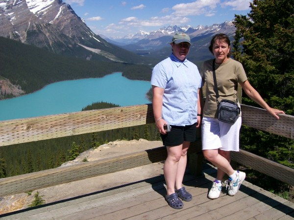
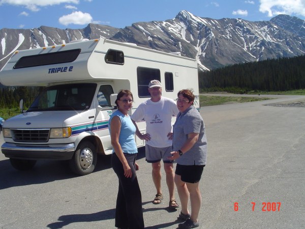
The girls, Michèle and Suzie. The two boys, Denis and Rolland.
The trail taking us back to our motorhome., The trees on either side of the trail are over 300 years old.
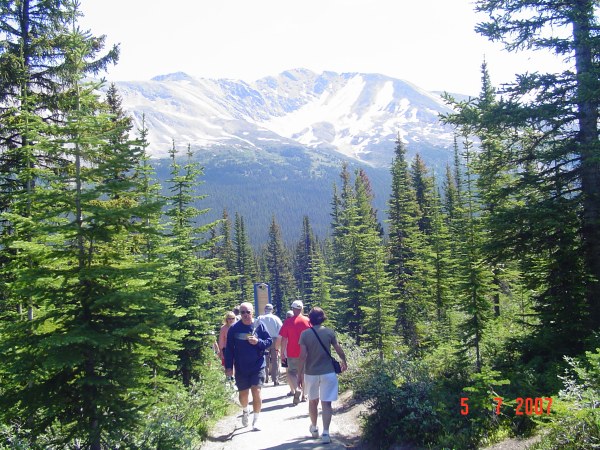
You can see parts of lake Mistaya between the trees.
Our first sighting of Mount Chephren.
Hummm! What can I say!
Waterfowl lake.
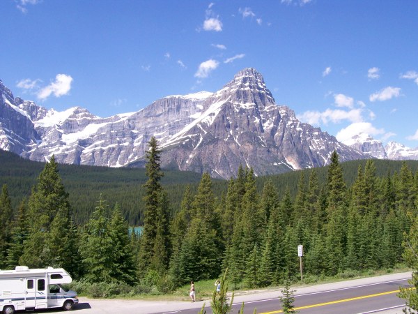
And we are getting closer to Mount Chephren (3,266m).
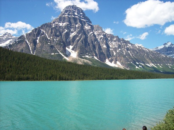
Looking south.
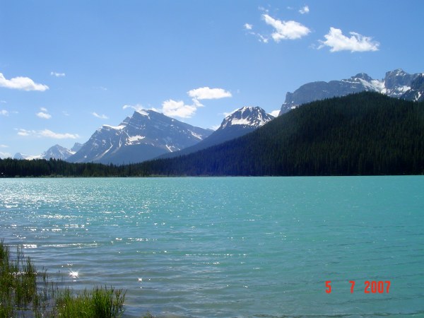
Looking north, you can see the glacier.
Closer...
And closer...
WOW! it looks small, but in reality, it is very big!
Pretty Suzie!
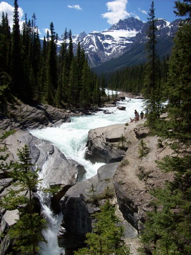
The next stop is Mistaya Canyon.
This canyon is as nice as others, but this one has fewer people visiting.
The next, we stop at Saskatchewan River Crossing where we have to do some laundry, empty our used water tanks and refill the freshwater tanks. Saskatchewan River Crossing is at the point where three rivers meet, the North Saskatchewan, the Mistaya and the Howse. It is also the lower point on the Icefield Parkway between Bow Sommet (2000 m) and the Sunwapta passage (more than 2000 m).
Another nice falls we saw in our travels.
We are spending the night at Rempart Creek right next to the North Saskatchewan River.
And another great meal.
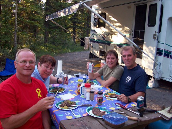
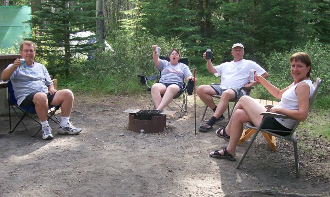
We have to relax, after all we did cover 72 km today!
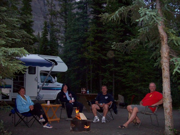
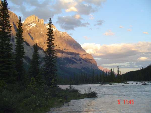
The timestamp in the photo is wrong, it is only 9:45 in the evening.
Still daylight on a very cold North Saskatchewan river.
I know I wrote it before, but another great day!
July 6, 2007
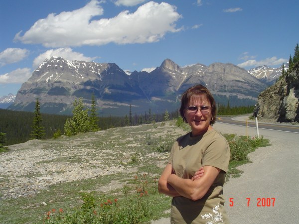
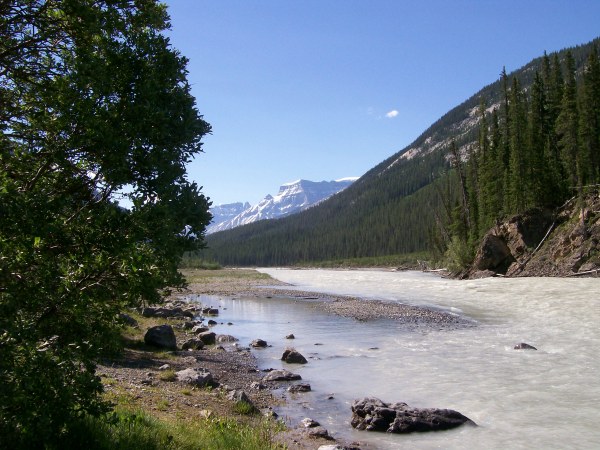
Once back on the road, we make many stops just to look around us.
The North Saskatchewan river looking downstream and looking upstream.
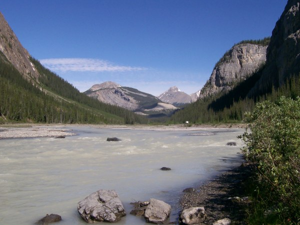
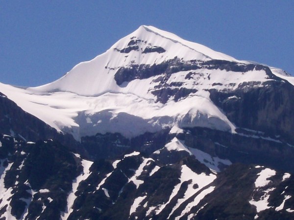
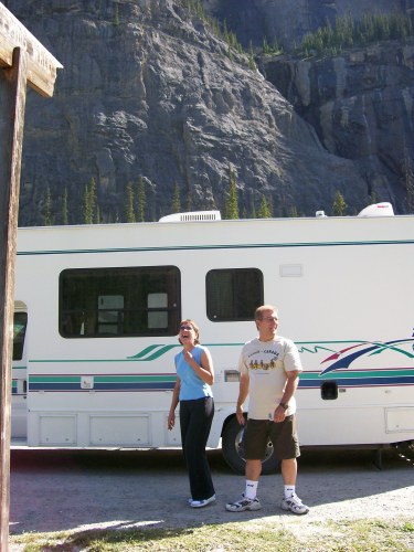
Rolland: "I'm telling you, this is the tallest one".
Denis: "You sure?".
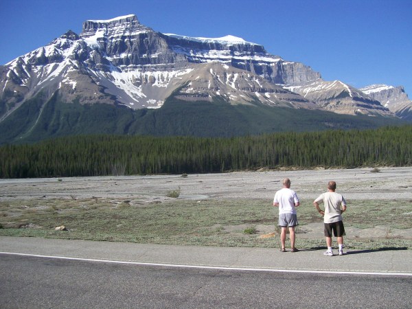
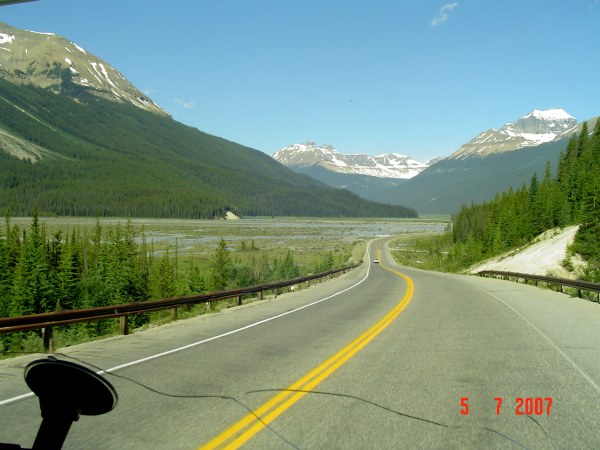
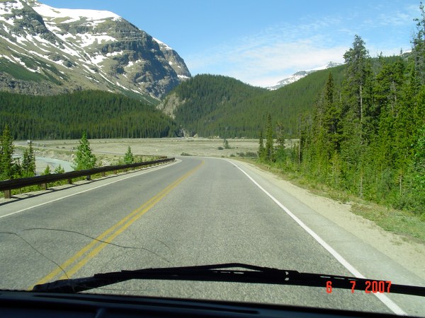
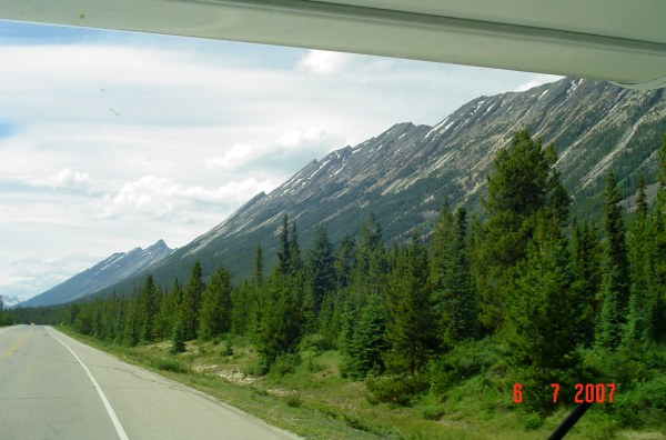
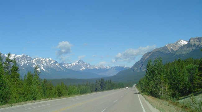
The Icefield Parkway is definitely one of the most scenic in the world.
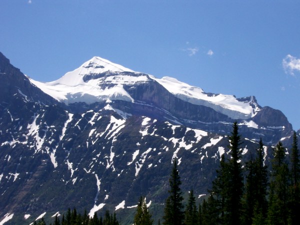
I forgot the name of the mountain, but it is BIG.
Many small streams are crossing the road, according to Rolland, it is very cold.
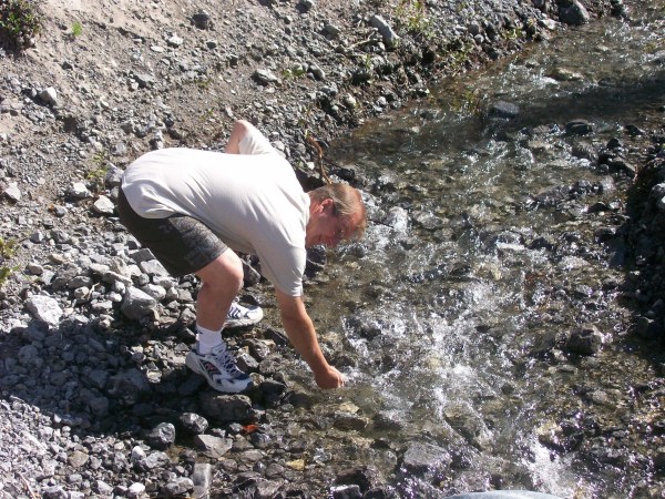
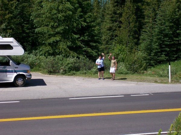
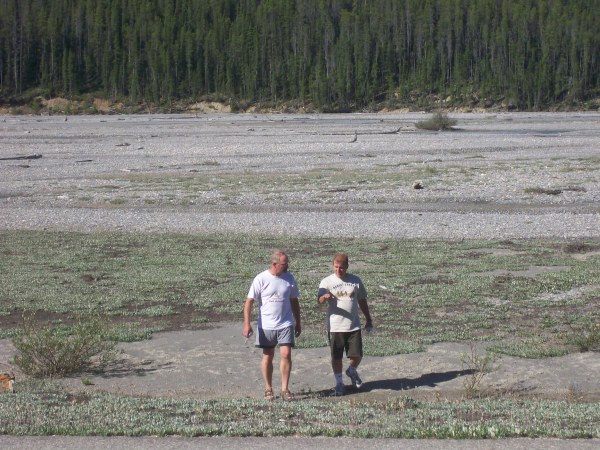
Just having fun!
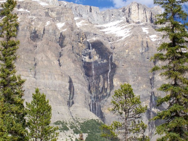
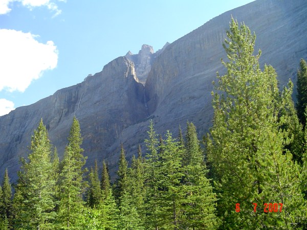
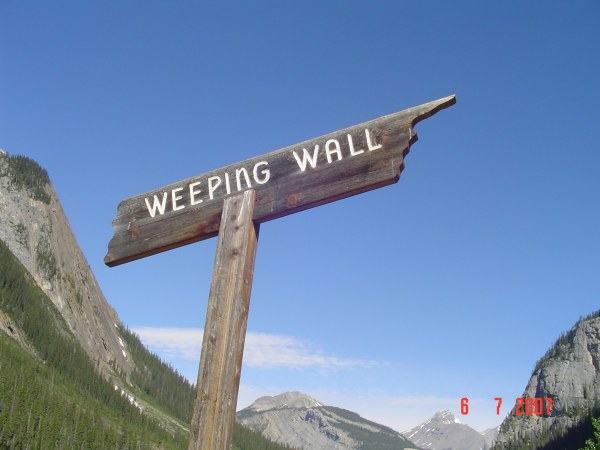
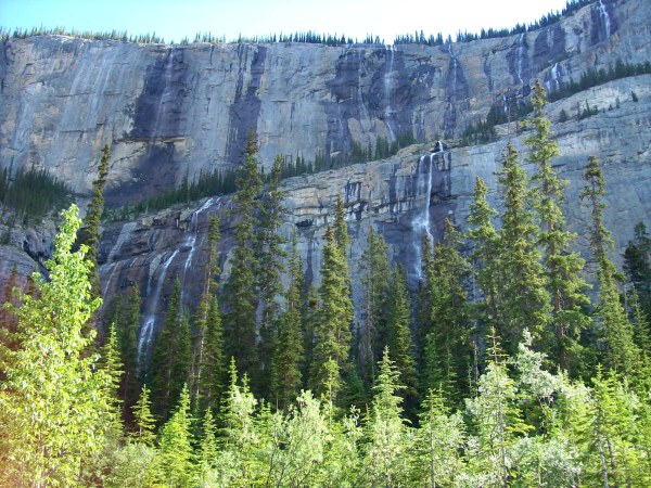
"Weeping Wall", so pretty. I can just imagine what is above, lots of snow?
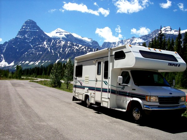
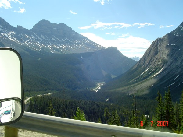
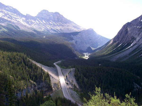
Coming up to the "Big Bend". You can see the road turning left and then coming around to go up the side of the mountain.
Can you see the big motorhome?
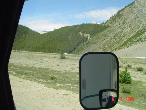
On the right, where we came from and on the left, where we are going.
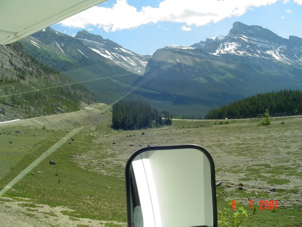
It may not look like a very steep hill, but from the bottom of the valley, at 1700m to the top, at 2100m in only 10 km!
Looking south.
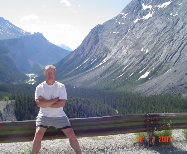
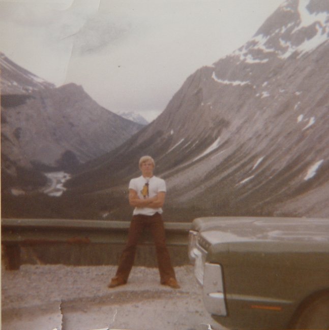
Here is something special, a photo of me in 2007 and another one of me in 1976!
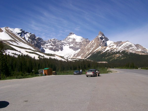
Parker's Ridge.
I must be telling some lies!
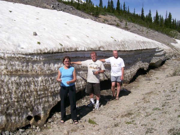
A few kilometers later we hit our first snow.
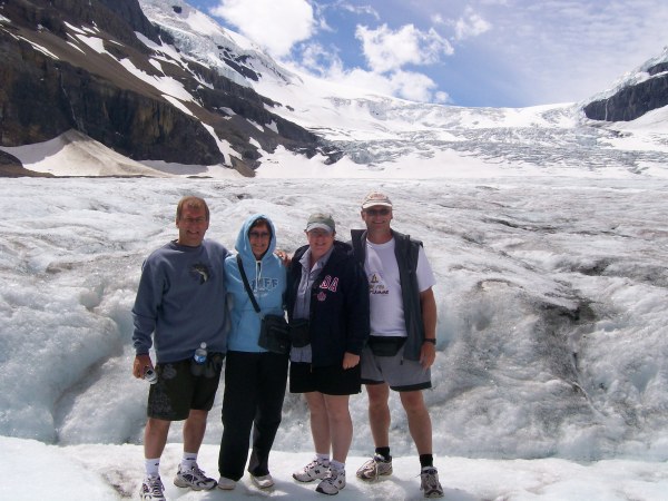
Here we are at the Columbia Icefield. More precisely at the Athabasca glacier.
The wall you see on the right is the lateral moraine left from the Athabasca Glacier.
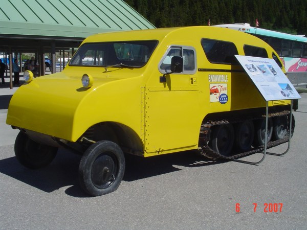
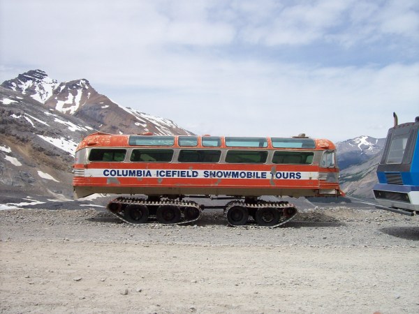
One of the first snowcoach the Brewster company had to tour the glacier.
The next vehicle they used was this converted bus.
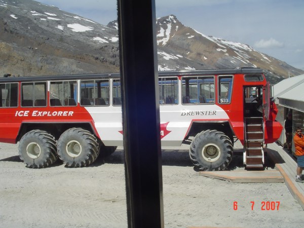
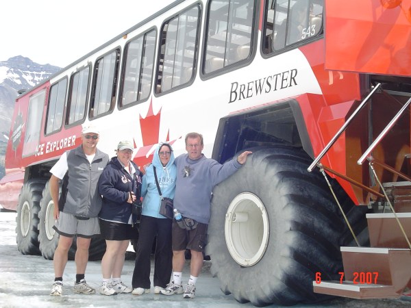
And the latest they use. The SnowCoachs, built in Calgary at $500,000.00 each.
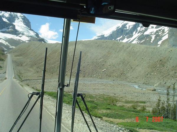
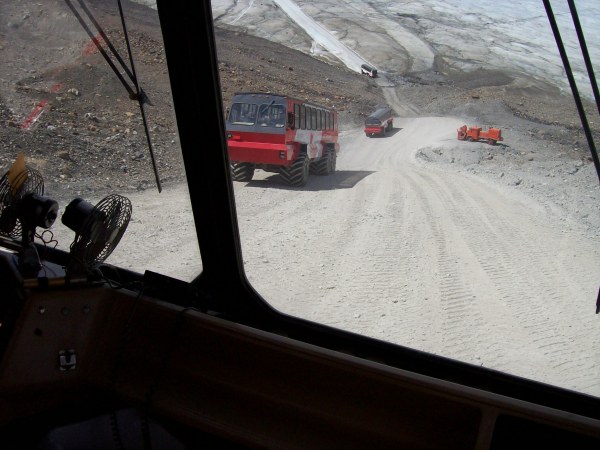
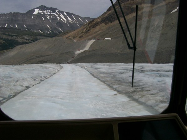
Right from the start, we have to go down this very steep hill. On the top of the photo, you can see the road we will take and the "old" road used earlier.
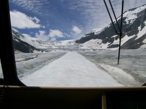
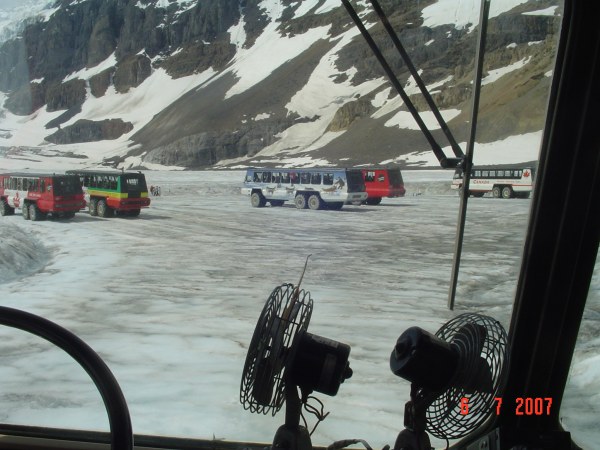
On the ice road, on the Athabasca glacier.
The parking lot on the glacier.
The Athabasca glacier is 320m deep at this point.
The snowcoach is pretty big.
Let me tell you, it is pretty cool for our legs on the glacier.
The glacier moves at a rate of 125 m per year, or about 30 cm per day.
The Andromeda glacier.
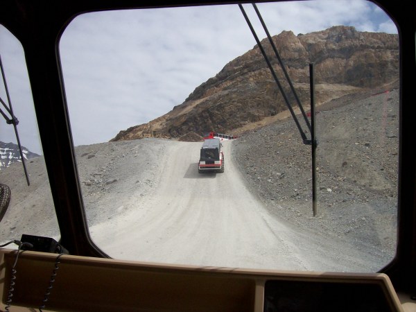
On our way back. You can see the hill we came down on.
Got to go up!
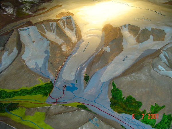
A model of the Columbia Icefield with the Athabasca glacier in the center.
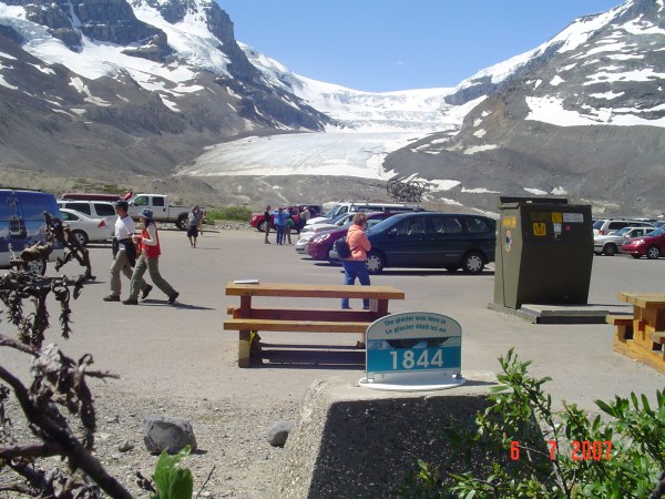
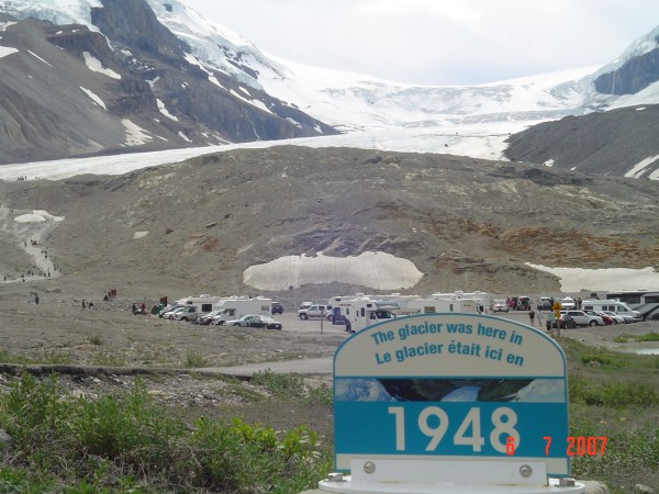
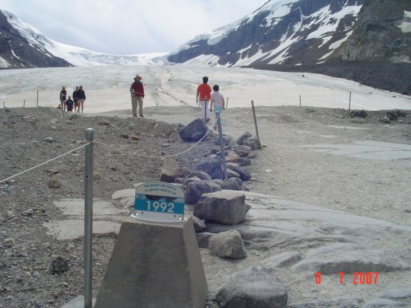
A view from the information center. The small indicator panel with the number 1844 is to inform us of the position of the glacier in that year.
At this time, the glacier is 1 km wide and 6 km long. Since 1870, the glacier has receded by 1 km.
The location of the glacier in 1925. Still a long way to the glacier.
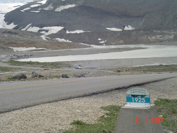
It sure makes it "real" about global warming!
Just a few meters below the 1984 is where my mom and I stood on the ice in 1976!
Pretty impressive to see the scouring marks left by the glacier when it moved over the rock face.
2007, Denis and Rolland, in 30 years where will be the glacier, will it still be there?
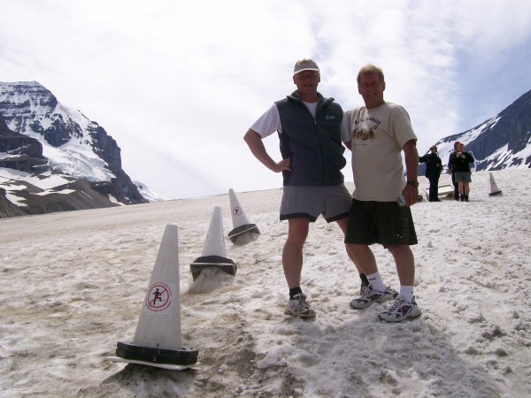
A very interesting place to visit, I highly recommend the Athabasca Glacier.
Back on the road and traveling north.
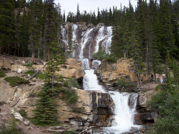
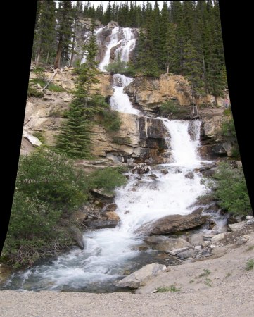
Tangle Creek Falls, beautiful.
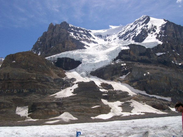
The Stutfield glacier, it is part of the Columbia Icefield.
The ice face we see will fall 900 m.
The Endless range.
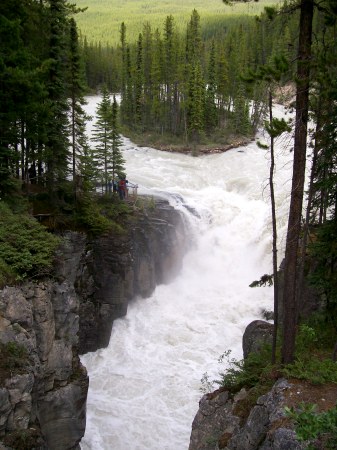
Another set of falls worth stopping for, the Sunwapta falls.
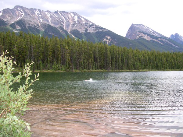
Our last stop for the night before Jasper is at Honeymoon Lake.
The water is actually warm, a nice swim with a beautiful backdrop of the Endless range.
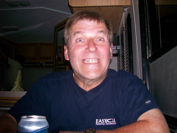
Rolland just before bed!!!
Our days are so full, we would still need more hours in a day to do all we want to do.
July 7, 2007
Only 30 km to Jasper, but as usual for us, it will take all day to get there.
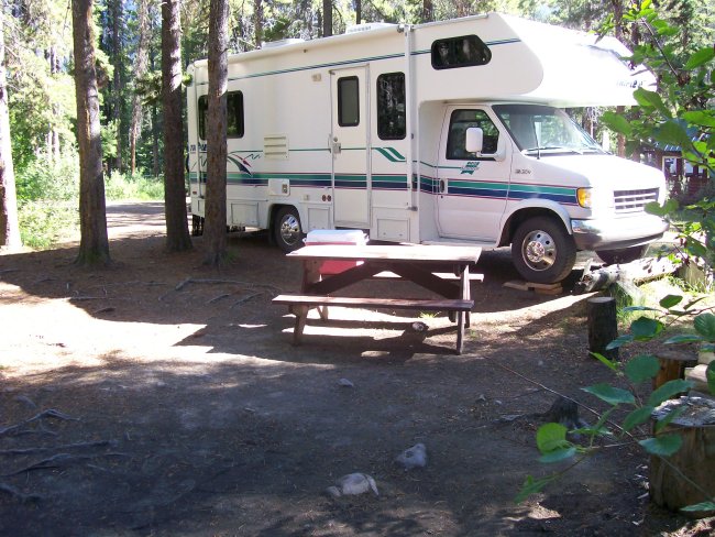
First here is our site at Honeymoon Lake. Small campground with only 35 site. Very pretty.
The scenery is so gorgeous.
Looks like a painting by some famous painter.
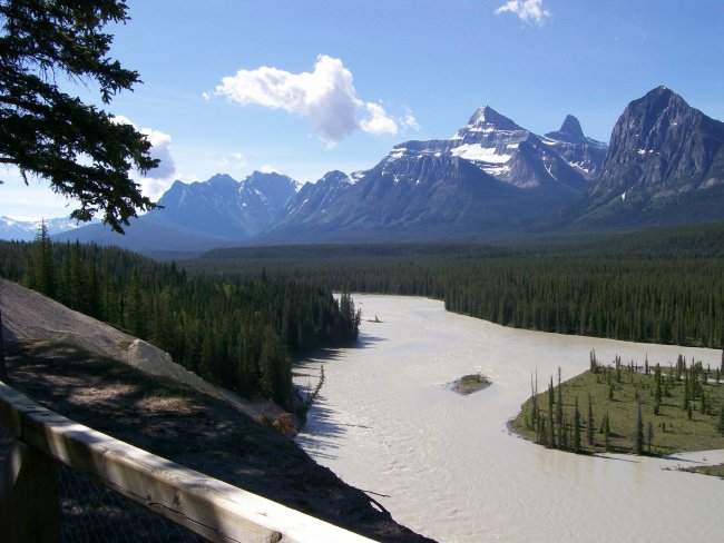
Mont Christie, 3,103 m. In the foreground, the Athabasca river coming from the Athabasca glacier.
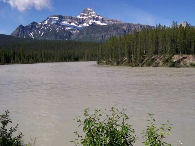
Another view of Mont Christie. The sediment is what gives the water this grayish colour.
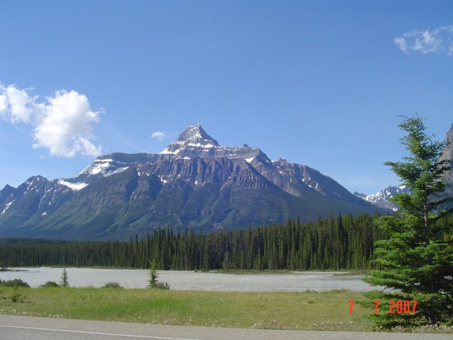
If you look at the tree line on the mountain, some patches are a light green compare to the lower elevation. This is due to the avalanche ripping the trees and the new growth that takes place after.
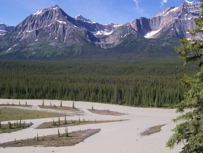
A small little lake by the parkway. You can see the different colour in the water, but in real life it is even more beautiful.
The colours come from the sediment left in suspension in the water.
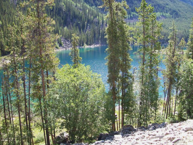
Just gorgeous.
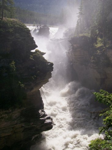
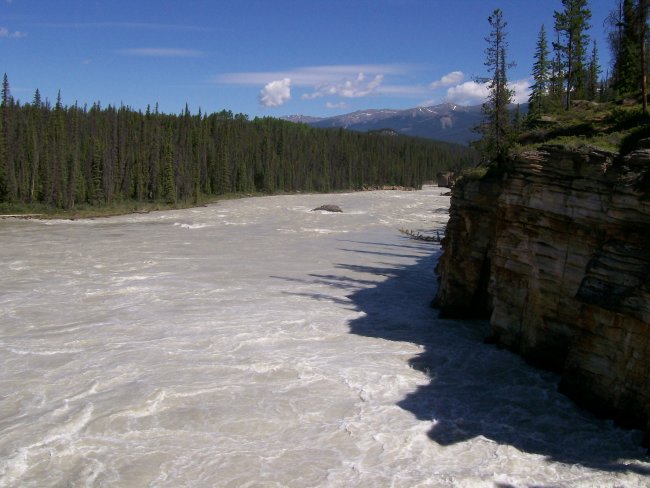
A must stop, the Athabasca falls.
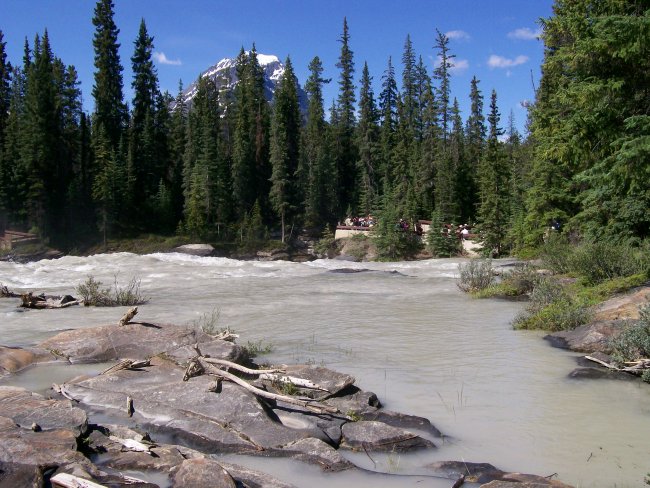
We spend a few hours visiting and just enjoying the place.
Finally made it to Jasper. We drink to that!
We are at the Whistlers campground just a few kilometers from Jasper.
Next, from July 8 - 10.
June 28 to July 1st July 2 - 4 July 5 - 7 July 8 - 10 July 11 - 14 July 15 - 23
The Canadian Rockies.
July 5 to 7, 2007
July 5, 2007
Choosing the photos for today was very hard, so many good ones.
OK! Here is one of the mountains. We can see from our campground.
The four of us at Bow Lake with the Crowfoot lake and glacier.
Beautiful lake.
The house you see in the distance is actually a lodge, the Num-Ti'Jah Lodge. It is 4 stories high.
Sorry, but I did not take the English version of the information. Just to tell you that we are very high, at 2,085 m. This is the highest point on the parkway.
Peyto Lake, named after the explorer Mr. Peyto himself. You can see the road in the distance toward the right. This view is looking north.
Don't you think the lake looks like a dog?
Or maybe a ghost?
The girls, Michèle and Suzie. The two boys, Denis and Rolland.
The trail taking us back to our motorhome., The trees on either side of the trail are over 300 years old.
You can see parts of lake Mistaya between the trees.
Our first sighting of Mount Chephren.
Hummm! What can I say!
Waterfowl lake.
And we are getting closer to Mount Chephren (3,266m).
Looking south.
Looking north, you can see the glacier.
Closer...
And closer...
WOW! it looks small, but in reality, it is very big!
Pretty Suzie!
The next stop is Mistaya Canyon.
This canyon is as nice as others, but this one has fewer people visiting.
The next, we stop at Saskatchewan River Crossing where we have to do some laundry, empty our used water tanks and refill the freshwater tanks. Saskatchewan River Crossing is at the point where three rivers meet, the North Saskatchewan, the Mistaya and the Howse. It is also the lower point on the Icefield Parkway between Bow Sommet (2000 m) and the Sunwapta passage (more than 2000 m).
Another nice falls we saw in our travels.
We are spending the night at Rempart Creek right next to the North Saskatchewan River.
And another great meal.
We have to relax, after all we did cover 72 km today!
The timestamp in the photo is wrong, it is only 9:45 in the evening.
Still daylight on a very cold North Saskatchewan river.
I know I wrote it before, but another great day!
July 6, 2007
Once back on the road, we make many stops just to look around us.
The North Saskatchewan river looking downstream and looking upstream.
Rolland: "I'm telling you, this is the tallest one".
Denis: "You sure?".
The Icefield Parkway is definitely one of the most scenic in the world.
I forgot the name of the mountain, but it is BIG.
Many small streams are crossing the road, according to Rolland, it is very cold.
Just having fun!
"Weeping Wall", so pretty. I can just imagine what is above, lots of snow?
Coming up to the "Big Bend". You can see the road turning left and then coming around to go up the side of the mountain.
Can you see the big motorhome?
On the right, where we came from and on the left, where we are going.
It may not look like a very steep hill, but from the bottom of the valley, at 1700m to the top, at 2100m in only 10 km!
Looking south.
Here is something special, a photo of me in 2007 and another one of me in 1976!
Parker's Ridge.
I must be telling some lies!
A few kilometers later we hit our first snow.
Here we are at the Columbia Icefield. More precisely at the Athabasca glacier.
The wall you see on the right is the lateral moraine left from the Athabasca Glacier.
One of the first snowcoach the Brewster company had to tour the glacier.
The next vehicle they used was this converted bus.
And the latest they use. The SnowCoachs, built in Calgary at $500,000.00 each.
Right from the start, we have to go down this very steep hill. On the top of the photo, you can see the road we will take and the "old" road used earlier.
On the ice road, on the Athabasca glacier.
The parking lot on the glacier.
The Athabasca glacier is 320m deep at this point.
The snowcoach is pretty big.
Let me tell you, it is pretty cool for our legs on the glacier.
The glacier moves at a rate of 125 m per year, or about 30 cm per day.
The Andromeda glacier.
On our way back. You can see the hill we came down on.
Got to go up!
A model of the Columbia Icefield with the Athabasca glacier in the center.
A view from the information center. The small indicator panel with the number 1844 is to inform us of the position of the glacier in that year.
At this time, the glacier is 1 km wide and 6 km long. Since 1870, the glacier has receded by 1 km.
The location of the glacier in 1925. Still a long way to the glacier.
It sure makes it "real" about global warming!
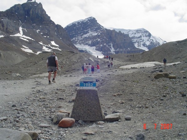
Just a few meters below the 1984 is where my mom and I stood on the ice in 1976!
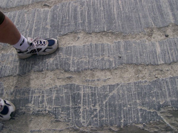
Pretty impressive to see the scouring marks left by the glacier when it moved over the rock face.
2007, Denis and Rolland, in 30 years where will be the glacier, will it still be there?
A very interesting place to visit, I highly recommend the Athabasca Glacier.
Back on the road and traveling north.
Tangle Creek Falls, beautiful.
The Stutfield glacier, it is part of the Columbia Icefield.
The ice face we see will fall 900 m.
The Endless range.
Another set of falls worth stopping for, the Sunwapta falls.
Our last stop for the night before Jasper is at Honeymoon Lake.
The water is actually warm, a nice swim with a beautiful backdrop of the Endless range.
Rolland just before bed!!!
Our days are so full, we would still need more hours in a day to do all we want to do.
July 7, 2007
Only 30 km to Jasper, but as usual for us, it will take all day to get there.
First here is our site at Honeymoon Lake. Small campground with only 35 site. Very pretty.
The scenery is so gorgeous.
Looks like a painting by some famous painter.
Mont Christie, 3,103 m. In the foreground, the Athabasca river coming from the Athabasca glacier.
Another view of Mont Christie. The sediment is what gives the water this grayish colour.
If you look at the tree line on the mountain, some patches are a light green compare to the lower elevation. This is due to the avalanche ripping the trees and the new growth that takes place after.
A small little lake by the parkway. You can see the different colour in the water, but in real life it is even more beautiful.
The colours come from the sediment left in suspension in the water.
Just gorgeous.
A must stop, the Athabasca falls.
We spend a few hours visiting and just enjoying the place.
Finally made it to Jasper. We drink to that!
We are at the Whistlers campground just a few kilometers from Jasper.
Next, from July 8 - 10.
  © COPYRIGHT 2012 ALL RIGHTS RESERVED MICHELE-DENIS.COM |
 |